
What Does a PAS 128 Utility Survey Cost in Ireland? Understanding the Quote
The practical cost drivers behind a PAS 128 utility survey, with a checklist for comparing scope, verification, access, deliverables and exclusions.
The most consequential line on a utility drawing may be the one that is missing. Better decisions begin by understanding how underground information was obtained, where it remains uncertain, and what to investigate next.
5 MIN READ · Editorial date 16 January 2026
Reviewed 25 September 2026 · This edition includes later research.
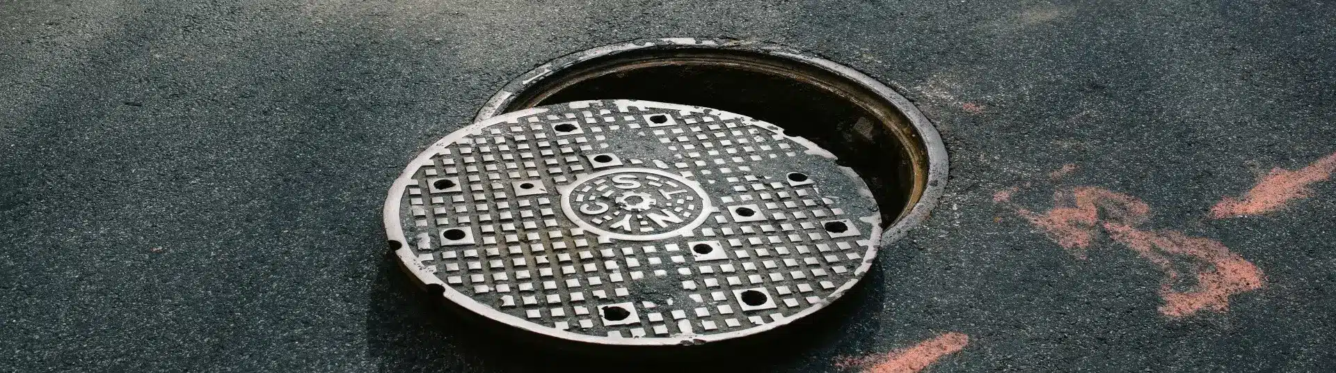
Utility detection brings together instrument readings, site evidence and interpretation.
A map is evidence with limits, rather than a guarantee that every service has been found.
Survey uncertainty should change the design and verification plan, not disappear into a drawing note.
Capture new installations before backfilling so the next project starts with better information.
A street is rarely the product of one coordinated installation. Water mains, electricity cables, communications ducts and private connections arrive at different times, under different contracts and with different recording practices. Later repairs add another layer. The physical network survives, while the knowledge about it may be scattered between owners, contractors and old project folders.
This is why a utility plan should be read as a piece of evidence. It may describe an asset accurately, approximately or incompletely. A neat digital line does not tell you which of those applies. Equally, an old drawing should not be dismissed merely because it looks dated: an offset, chamber reference or abandoned route can still provide a valuable lead.
The useful question is therefore more specific than “Have we got the drawings?” Ask who produced them, when they were updated, how they relate to the current site and which parts have been checked. A drawing register with those answers is more valuable than a large folder of unexplained PDFs.
There are several different unknowns. An asset may not appear in the records. Its route may be shown but its depth may be uncertain. A detected signal may be difficult to distinguish from nearby services. A location may be inaccessible. Treating all of these as one generic disclaimer makes the information harder to use.
A practical response is to maintain a short uncertainty register alongside the survey. Record the location, the unresolved question, the potential consequence and the next action. A possible conflict at a foundation needs a different response from an uncertain route beyond the work boundary.
This also changes how a design review works. The team can decide whether to move the design, seek more evidence or introduce a hold point. Uncertainty becomes a managed project item with an owner and a decision date, rather than a surprise passed to the excavation crew.
PAS 128:2022 provides a specification for utility detection, verification and location. Its survey types cover records, site reconnaissance, detection and physical verification. These are not four interchangeable products with a universal confidence score.
The Survey Association client guide distinguishes the survey type commissioned from the quality level achieved for an individual utility segment. Detection results can vary along one route, and a suspected but undetected service may remain an assumed alignment.
For a designer, that distinction matters at the interface with the proposed work. A generally well-detected route can still need physical verification at a critical crossing. Verification at one exposure should not be stretched into a claim that the entire line has been proven. The drawing and report should make those limits clear.
Identify the source of each route: records, observed evidence, detection or exposure.
Read the achieved quality and limitations for the segment near the work.
Agree targeted verification where a conflict has significant consequences.
Ground-penetrating radar and electromagnetic location provide different forms of evidence. Their usefulness depends on the target, ground conditions, access and the way the survey is carried out. Combining evidence is often more informative than relying on a single instrument.
GNSS and total stations help position the observations. Aerial LiDAR and terrestrial scanning can add valuable surface context, but they do not directly reveal buried services. This distinction prevents a visually impressive surface model from being mistaken for an underground investigation.
Consider an illustrative drainage connection. The available plan shows a route towards a chamber, while site observations and detection suggest a different alignment. Averaging the two routes into a tidy line would conceal the problem. The better output is a documented discrepancy and a proportionate plan to resolve it before the connection is designed or excavated.
The HSA underground-services code addresses clients, designers, project supervisors, contractors and others involved in work near buried services. It places the survey within a wider safe system of work, rather than treating the drawing as permission to excavate.
A useful handover explains what was surveyed, what was not accessible and where further checks are needed. It should allow the people planning the work to connect the information to the current construction sequence. If the design changes, the original survey extent and the remaining uncertainty need another look.
Version control is part of that handover. Put the drawing revision, survey date, coordinate reference and limitations in places that will survive printing and sharing. An accurate file can still cause trouble if an older copy is the one used on site.
The strongest opportunity to improve underground information often arrives during construction. Once a service is exposed or a new asset is installed, the project has a brief window to record information that will be expensive to recover later.
Agree the record requirements before that window opens. Identify which positions and levels matter, which photographs need a location reference, who checks the information and who receives the final record. A photograph without orientation or context may be difficult to interpret once the trench is closed.
Our editorial view is that the value of a utility survey should be judged partly by the decisions it enables: conflicts identified earlier, verification focused on consequential locations, and a record that another team can understand. A more colourful plan is not necessarily a more useful one. A transparent chain of evidence usually is.
The underground will always contain uncertainty. The aim is to make that uncertainty visible early, investigate it proportionately and carry the evidence through to construction and the final asset record.
Sources checked on 25 September 2026. Current guidance and policy updates belong to this reviewed edition, rather than the earlier assigned editorial date.
Irish safe-working guidance, including the limitations of plans and the responsibilities of project participants.
Specification for underground utility detection, verification and location.
Distinguishes survey types from achieved quality levels and explains undetected and assumed routes.


2 Bridge St, Athlone, Co. Westmeath, N37 F1W4
+353 (090) 640 3114
info@utilistics.ie
Mo - Fri : 08:00am - 17:30pm
Sat : 09:00am - 14:00pm