
From Point Cloud to Digital Twin: What Makes Survey Data Useful Over Time?
Understand the steps between a point cloud, a BIM model and a digital twin, including purpose, asset data, updates, governance and Irish BIM requirements.
Laser scanning is a way to capture information. A measured building survey is a defined survey service and set of outputs. Understanding the difference helps you commission what the design actually needs.
5 MIN READ · Editorial date 9 April 2026
Reviewed 25 September 2026 · This edition includes later research.
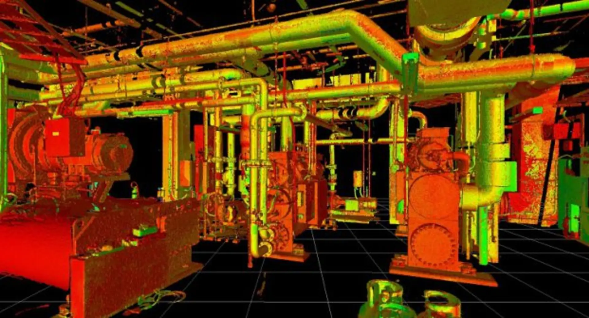
A point cloud records visible geometry; a finished survey adds structure and interpretation.
Choose the required drawings, model and accuracy before selecting a capture method.
Dense point clouds still contain occlusions, uncertainty and interpretation.
Agree what is measured, modelled, inferred and excluded.
A measured building survey may provide floor plans, elevations, sections, levels or a three-dimensional model. Laser scanning can support those outputs, alongside total-station observations, direct measurements and photography. The methods can complement one another within one survey.
Scanning records many observations of visible surfaces from each instrument position. The resulting point cloud can be valuable where geometry is complex or where the team needs to revisit the captured scene during design. It does not automatically supply a finished set of measured drawings.
For a modest alteration with a narrow information requirement, a targeted survey may be entirely appropriate. For a complex refurbishment with multiple disciplines and congested services, broader capture may be worthwhile. The choice should follow the design question and the consequences of missing information.
Line of sight governs what terrestrial scanning records. Furniture, equipment, occupied rooms, ceiling finishes and restricted spaces can conceal important surfaces. Additional positions can improve coverage, but inaccessible areas still need to be identified.
A ceiling surface is not evidence of the structure or services above it. A pipe seen from one side may not provide enough information to determine every connection. The deliverable should distinguish observed geometry from assumptions, particularly where a model appears more complete than the underlying evidence.
This is a reason to discuss access early. Agreed shutdown periods, keys, escorts, safe access arrangements and the removal of movable obstructions can improve the usefulness of capture. They may matter more than increasing the point density.
Instrument specifications, point spacing, registration results and final survey accuracy describe different things. A low registration residual indicates how a particular alignment fits its observations; it is not, by itself, independent proof that every feature in the finished model meets the project requirement.
The capture plan should address control, registration and appropriate checks. State the required accuracy in terms that relate to the intended use. Coordinating a new service through a tight opening has different consequences from preparing a general space-planning background.
The coordinate and level reference also needs agreement. A cloud can be internally consistent without being positioned correctly in the project system. Check the relationship between the survey, existing drawings and the design model before combining them.
A registered point cloud preserves a rich record of the captured surfaces. Two-dimensional drawings organise selected information into a conventional design reference. A BIM model adds structured objects and agreed information. Each requires a different amount of interpretation and production work.
Specify the output formats, drawing scale where relevant, model uses and required elements. Agree how irregular geometry will be represented and how hidden or inaccessible features will be marked. “Scan to BIM” is too broad to serve as a complete specification.
Also establish software compatibility and practical file handling. A technically detailed dataset that the receiving team cannot open or navigate is a poor handover. A small sample issue can expose problems with units, coordinates, naming or model expectations before the full delivery.
Define the plans, elevations, sections or model elements required.
Agree accuracy, reference system and independent checks.
Identify inaccessible areas and rules for inferred geometry.
Confirm file formats, software versions and review milestones.
A geometric survey and a floor-area assessment are related but distinct services. Area calculations depend on a stated measurement basis and its treatment of walls, common areas, voids and other features. Two different bases can produce different figures from the same building geometry.
As checked on 25 September 2026, RICS advises continued use of the sixth edition of the Code of measuring practice and/or IPMS: All Buildings while the proposed seventh edition is under consultation. The appropriate basis should satisfy the instruction and be documented.
Do not request “the floor area” without explaining its purpose. A leasing exercise, cost assessment and internal space-management study may need different treatment. Record the basis beside the result so that later users can interpret it correctly.
Review the survey against a few real design questions. Can the team understand the critical floor-to-floor relationship? Is the proposed opening represented with sufficient evidence? Are the required interfaces visible, or has a gap been covered by modelling assumptions?
The answers help decide whether further investigation is worthwhile. A targeted return visit can be more useful than a uniformly denser survey. Equally, a carefully limited deliverable can be sufficient when the intended use is narrow and its limits are clear.
The RICS measured-survey guidance is a useful reference when preparing that scope. The objective is a proportionate record that designers can understand, check and use.
The strongest commission begins with a design purpose and a clear handover. Capture technology is valuable when it supports those requirements and its limitations remain visible.
Sources checked on 25 September 2026. Current guidance and policy updates belong to this reviewed edition, rather than the earlier assigned editorial date.
Professional guidance for specifying measured surveys and their deliverables.
Current advice on the sixth edition and IPMS: All Buildings while the proposed seventh edition is under consultation.


2 Bridge St, Athlone, Co. Westmeath, N37 F1W4
+353 (090) 640 3114
info@utilistics.ie
Mo - Fri : 08:00am - 17:30pm
Sat : 09:00am - 14:00pm