
Setting Out on Site: Control, Checks and Responsibilities
A practical guide to setting-out control, design revisions, tolerance, independent checks and the responsibilities to agree before construction.
Before a design can respond to a site, the team needs a reliable description of its shape and visible features. A topographic survey provides that foundation, provided its scope answers the right questions.
5 MIN READ · Editorial date 18 March 2026
Reviewed 25 September 2026 · This edition includes later research.
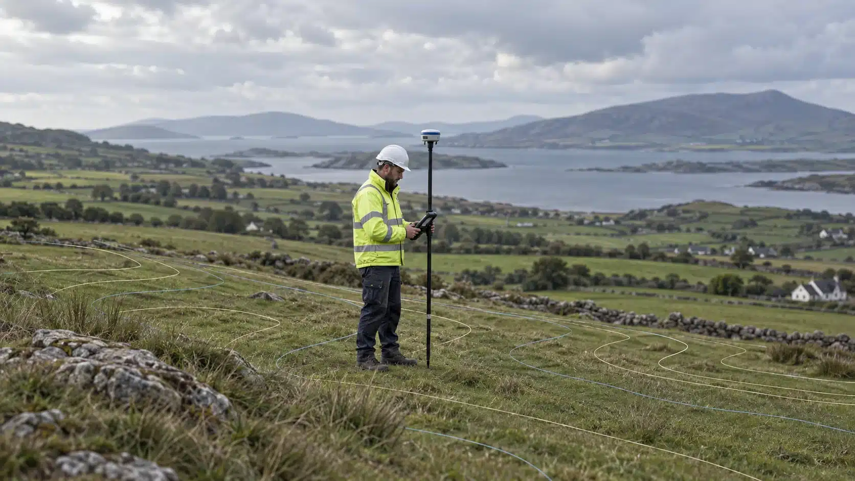
Specify the design purpose and survey extent before choosing the equipment.
Agree coordinate and height references, feature detail and digital deliverables.
Check coverage and limitations as carefully as the drawing presentation.
A topographic survey records selected visible features and levels so that their positions and relationships can be understood. Depending on the brief, that may include buildings, roads, kerbs, walls, fences, trees, watercourses, changes in ground level and visible drainage or service features.
The word “selected” matters. No survey records every physical detail at every scale. A planning layout, a drainage design and a detailed road tie-in can need different coverage and precision. A useful commission describes the decision the information must support, not simply the size of the plot.
A boundary fence may be surveyed as a physical feature. Its position does not, by itself, establish the legal boundary or ownership. Similarly, a chamber cover can be measured without identifying the complete underground network connected to it. Those questions may require separate investigation.
The RICS measured-survey guidance provides a professional framework for survey specifications. In practice, the most useful starting point is a marked extent plan accompanied by the intended use and required outputs.
Think beyond the proposed building footprint. A drainage connection may need downstream levels; an entrance design may depend on the adjoining road; a retaining structure may need ground information on both sides. Off-site coverage also requires appropriate access and permission. Identify these interfaces before mobilisation.
Be explicit about features that need special attention. Chamber invert information, tree details, overhead clearances or internal floor levels should not be assumed to be included. Access restrictions, vegetation, traffic and occupied areas can affect what can safely be measured.
Mark the survey boundary and any off-site tie-ins.
State the design purpose and required accuracy.
List critical features and any separate investigations.
Agree access arrangements, programme and deliverable formats.
A coordinate system describes positions; a height datum provides the reference for levels. They are related project decisions, but they are not interchangeable. An Irish project may require Irish Transverse Mercator coordinates and an agreed national height reference, or a clearly defined local site system.
State the required system, datum, units and any project transformation in the brief and on the deliverables. If the design team is working in a local grid, agree how it relates to survey control. A beautifully drawn survey can create serious confusion when its reference differs from the design.
Existing control points also need checking. A label on an old plan does not establish that a physical mark remains stable or that its recorded value is suitable. The survey report should explain the reference used and any limitations that affect future work.
A drawing and a digital terrain model answer different questions. The drawing communicates features and levels. The terrain model represents a surface constructed from observations, with breaklines and other constraints used to preserve significant changes such as kerbs, banks and channels.
A digital surface model can include roofs, vegetation and other above-ground objects. A terrain model aims to represent the ground. These products should be named clearly, especially when aerial capture forms part of the survey.
Do not assume that every triangle in a model represents directly observed ground. Dense vegetation, water, parked vehicles or inaccessible areas can leave gaps. The extent of interpolation and any excluded areas should be explained. A drainage designer needs to know where a surface is measured and where further information is required.
The field visit is only one part of delivery. Planning access, establishing control, collecting observations, processing data, checking the model and preparing drawings all take time. A short site visit does not necessarily mean that a checked drawing can be issued that afternoon.
Extent alone is a poor predictor. A small, congested industrial site can take more effort than a larger open area. Traffic management, restricted working hours, dense detail, vegetation and repeat visits can affect the programme. Weather can also influence access and the suitability of particular capture methods.
Ask for separate dates for fieldwork and the checked issue. If the design programme needs an early release, agree what that release contains, how it will be marked and what remains outstanding. Preliminary information should be recognisable as preliminary wherever it is used.
Open the digital files in the software that the project will actually use. Confirm units, coordinate position, levels and layer conventions before design work becomes dependent on them. Compare the delivered extent with the agreed plan and review any qualifications.
For an illustrative access-road project, the critical check may be whether the surveyed road levels extend far enough to design the tie-in. For a drainage layout, it may be whether the outfall information is included and reliable. A general visual review cannot replace those project-specific checks.
Keep the issue date and revision visible. Sites change after earthworks, demolition or installation. An older survey can remain valuable background information while needing targeted updates before the next design or construction decision.
A good topographic survey makes the site easier to understand and the next decision easier to justify. A clear brief, a shared reference and a careful handover help turn observations into useful design information.
Sources checked on 25 September 2026. Current guidance and policy updates belong to this reviewed edition, rather than the earlier assigned editorial date.
Professional guidance for specifying measured surveys and their deliverables.

2 Bridge St, Athlone, Co. Westmeath, N37 F1W4
+353 (090) 640 3114
info@utilistics.ie
Mo - Fri : 08:00am - 17:30pm
Sat : 09:00am - 14:00pm